Ethnic Linguistic Landscapes
Using AI to map emerging, suburban, ethnic placemaking
Driven by globalization and middle-class immigration, 21st-century migrants increasingly settle in suburbs, forming ethnoburbs—dispersed, culturally hybrid enclaves with indistinct boundaries, whose form differs notably from the tightly concentrated enclaves of the 19th and 20th centuries. In Metro Detroit, for example, opportunities in the auto industry's technology sector and in medicine have drawn Asian and Arab communities to the suburbs, where they have built vibrant, active communities—even as those communities remain spread across wide areas, making them harder to identify at a glance.
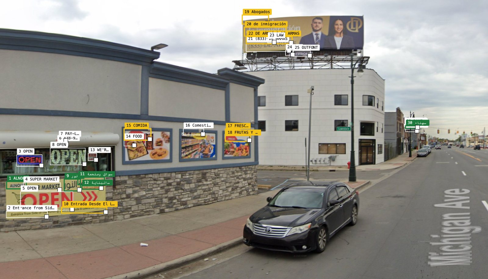
This project uses artificial intelligence to analyze thousands of Google Street View images across the region, identifying signs of everyday cultural life: business names, window signage in different languages, decals on vehicles, and more. These visual details serve as indicators of where immigrant communities have established themselves and how they are shaping the suburbs, offering a new way to map culture, identity, and belonging in parts of the city that do not appear on traditional maps of ethnic neighborhoods